|
May 11, 2011
An isolated severe thunderstorm developed across Southwestern Waukesha County during the late afternoon hours on Wednesday. The Storm Prediction Center had most of the area under a Severe Thunderstorm Watch hinting at the possibility of damaging winds and isolated areas of large hail.
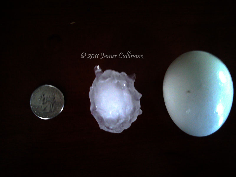
The storm appeared to weaken as it moved northeast but quickly gained strength as it approached Delafield and Hartland, Wisconsin. Storm Chasing Fever's very own, James Cullinane, was right in the path of the hail core from this storm. Marble to golf ball sized hail had fallen initially but some stones had reached 2.00 inches in diameter. That is just under the size of tennis balls!
The radar image below shows an intense hail core depicted by the purple colors over Hartland, Wisconsin. Shortly after, the severe thunderstorm dissipated as it move northeast into Washington County, Wisconsin. A well defined warm front, strong instability (warm, humid air) combined with cool mid level temperatures (steep lapse rates) contributed to the intense hail production. There were other reports of large hail across Jefferson County especially on highway 18 in the city of Jefferson. A 4.25 inch diameter stone had fallen from storms that developed earlier in the day.
Make sure to browse the news section for additional U.S. and Wisconsin weather news information.
Radar Images provided by Base Velocity, LLC - Radarscope iPhone App
|
